Showing posts with label travel. Show all posts

Monday, May 27, 2013

France 2013: Normandy, WWII, and Memorial Day


Happy Memorial Day in the USA!  Normally I think of the summer and barbecuing on Memorial Day.  But today is cold and rainy.  And my France experience is still on my mind.  It's only fitting that I write about Normandy and its WWII D-Day sites today.  Visiting these places certainly made me remember and honor those of us who have served for our countries.


The Normandy coast sits on the English Channel.  England is directly north.  Although it's not the closest place in France from England (Calais is), the Allies chose Normandy as its target for the D-Day invasion.  Five areas of coastline (known as Utah, Omaha, Gold, Juno, and Sword Beaches), were the landing points for the Allied troops.  For the rest of the story, go watch Saving Private Ryan :)

Normandy Coast Towns


The drive along the Normandy coast was relaxing.  There are a bunch of small seaside fishing towns.  Each one had some kind of memorial or museum dedicated to WWII.  I don't remember all the towns we went through, but it was all nice.  Too bad it was cold and rainy that day.  I would have enjoyed sitting on a pier and eating some seafood...


Perhaps the best scenic view of the Normandy coast was at Arromanches, pictured above.  Cliffs overlook the town on both sides, so you can get a great view.  There's a memorial/museum area here too.  Arromanches was the site of the WWII Mulberry Harbor, a portable temporary harbor built by the Allies to unload troops and supplies in order to win Europe back from the Nazis.  In the photo, the four objects in the water are remnants of the Mulberry Harbor.  There are some great WWII photos of the harbor in the museum onsite and on the internet (follow the link above).

Omaha Beach


When it comes to D-Day, Americans probably remember Omaha Beach the most.  Unlike the other beaches which were fairly easy to overtake, Omaha Beach was nasty.  It overlooked bluffs rising up to 150 ft.  German fortifications covered the beach.   Needless to say, thousands of people died on those beaches that day.  Once again, refer to Saving Private Ryan for more detail - its Omaha Beach invasion scene was amazing.


Today, there isn't much to see at Omaha Beach.  The area is a big memorial park now.  Almost all the fortifications are gone.  If you walk out a bit, you can see some bomb craters and perhaps a few remnants of the battle.


The main thing to see at Omaha Beach is the American Cemetery.  About 10,000 soldiers are buried here.  Makes you think about life a bit when you visit.  Thanks again to all those who have served.

It's crazy to think that the Nazis had a good chance of defeating the Brits and conquering all of Europe.  I was born a couple generations later, so the feeling wasn't the same as those who lived through it.  But seeing a few things sends a shiver down your spine.  On this trip, we had a long layover in Berlin and visited some of the landmarks there too.  They have a nice outdoor exhibit on the rise of the Nazi party in Germany.  And below is the Holocaust Memorial in Berlin - a tribute to the millions of Jews who were systematically persecuted and murdered by the Nazis.


Caen


There are a few bigger cities in the Normandy area.  One of them is Caen.  We stayed at a hotel there.  Caen was a major site in WWII during the Battle for Normandy (which started on D-Day). A significant portion of Caen was destroyed and was later rebuilt.  However, the medieval core of the city remains intact.  Below is the Chateau de Caen, or Caen Castle.  It was built by William the Conqueror, who led the Norman invasion to conquer England in 1066.  Across the street is the Church of St. Pierre, located across the street from the castle.  There are a few other churches you should see if you go there - Abbaye aux Hommes and Abbaye aux Dames - but we got lost and couldn't find a parking spot....


Related Links:

Saturday, May 25, 2013

France 2013: Le Mont St. Michel


Le Mont St. Michel is a very unique combination of characteristics: island, mountain, castle, monastery, medieval town, geological phenomenon, architectural marvel, and a place of legend.  Built sometime around 700-800 CE, the town and its fortifications have served a strategic role in the region over the centuries.  Le Mont has a special place in the hearts of the French.  Many songs, stories, and movies have referred to it.  I've personally wanted to visit it since I was young.  Finally seeing it in person was amazing.

Le Mont is located in a shallow bay in Normandy (northwestern France).   It is classified as a "tidal island," which means it is surrounded by water when the tides are high.  During low tide, you can walk over from the mainland.  Just don't get caught when the water rises; the water level goes up quickly, and the quicksand can be deadly!


Inside Le Mont St. Michel


There's a single road that connects the island to the mainland.  The road gets lots of traffic - 3.5 million tourists and Christian pilgrims visit the town every year.  They are currently renovating the area, changing the water flow with a new dam and building a new raised road leading to the town. There are a few small but expensive hotels on the island itself. We stayed on the mainland, however. It was much cheaper, and you can just walk or take a bus over to the island.


When you first enter the island, you walk through the tiny medieval town. Less than 30 people officially live on the island today. Le Mont has never had more than 1500 inhabitants over its entire history. The town probably had some interesting shops back in the day - carpenters, blacksmiths, etc. Today, it is only for tourists: souvenirs, food, and lodging. You need no more than a couple hours in town and less than a day at the site in general.

The fortifications of Le Mont are quite impressive. The island is completely surrounded by city walls. The central core of the mountain is situated at the top of the mountain and covered with more walls. Imagine launching projectiles from a catapult from the top!


The top of the mountain is reserved - for God!  There's a Gothic-styled Benedictine Abbey up there.  It is dedicated to Michael the Archangel. To get there, you need to walk up a bunch of stairs, but the view is amazing.  You can also pay a fee to tour the Abbey, but we chose not to do it.

The Tides


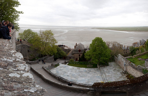
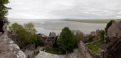
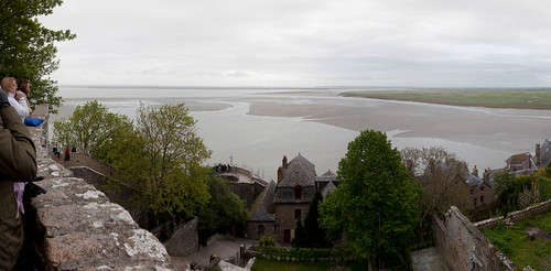
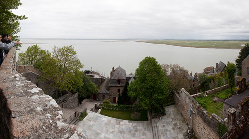
Perhaps the most unique aspect of Le Mont is the tidal flow.  I'm not aware of any other landmark in the world that is sometimes part of the mainland and sometimes an island.  It just takes about 60 minutes for high tide to cause the town to be completely surrounded by water.  We climbed the steps to the abbey and watched the tidal phenomenon happen.


#1: 7:22pm
#2: 7:46pm

#3: 7:58pm
#4: 8:14pm


Related Links:

Friday, May 24, 2013

France 2013: Trip Overview


Bonjour, messieurs et madames!  I just got back from a très magnifique, two-week trip to France.  Unlike my typical trips with friends, this one was a family vacation.  My parents just had their 40th anniversary, and I wanted to take them on a trek in Europe while their health was still in good shape. 
Our trip was spent entirely in northwestern France.  It was the second time in France for all of us. Aside from Paris, all the places we visited were new to us.

Trip itinerary & blog article index:


1) Flew in to Paris (A). With a long layover in Berlin
2) Normandy coast (B): The historic sites of the WWII D-Day invasion
3) Le Mont. St. Michel (C): The medieval city built on an island mountain (photo at top of this article)
4) Loire Valley (D): Region filled with beautiful chateaux (castles/mansions) built by French royalty
5) Chartres (E): Home of the beautiful gothic Cathédrale de Chartres.
6) Paris (F): 4+ days wandering the most beautiful city on the planet

As I write more, I will link to blog articles on the above locations. 

Here are maps of our trip.  The one on the left is a macro view, showing where we were in relation to France overall.  The one on the right shows more detail on the specific locations.


Getting Around

We rented a car to travel to all these locations. It was a great experience. The Normandy coast has a lot of small sites that you can visit, so having our own car allowed us to visit them at our own pace. The car was great for the Loire Valley too, since there are 10-20 chateaux you could visit. We planned around the big chateaux(Chambord, Chenonceau, Villandry); for the rest, we played it by ear. The French countryside was beautiful too. We really enjoyed driving through all the small towns and peaceful country roads.

When you rent a car in Europe, most cars you get are manual transmission. I was the sole driver, and I can only drive an automatic. So I reserved an automatic for a lot more money... but hey, it was a "premium class" rental - so they gave us a BMW 5 Series! What an awesome car for a road trip! The photo above is me with the BMW, in front of Chambord, the most grand of the chateaux in the Loire Valley. It also came with an excellent built-in GPS system, which saved us from getting lost many times.


Driving in Europe has its good points and its bad points. On the bright side, highway driving is great. Everyone is taught to drive very well, it seems. You rarely see slow drivers in the passing lane. People move aside to let faster drivers pass. And you don't see clueless cell-phone users cluttering up the roads. On the other hand, driving in cities and towns can be a pain! The streets are very small and crowded, and directions aren't marked clearly. Parking spots are tiny too. Most cars are very small compact and sub-compact cars; our BMW was quite a behemoth on the roads! Luckily, I managed not to hit anyone or anything...


The one place I did not drive in was Paris. Driving in Paris, just like any of the world's largest cities, is a complete mess! No way! We took public transporation instead. The metro and bus systems in Paris were excellent. Trains ran very frequently and were comfortable (and not smelly and rickety like Chicago's El hehe). The bus system was great too. Although the buses ran less frequently than the trains, there were more buses, and they covered lots of ground. It was nice to gaze out the window and admire the beauty of Paris during the bus rides. Tip to travelers: you can buy a "Mobilis" ticket that gives you unlimited train & bus rides in central paris for the great price of 6,60 EUR. Or a 5-day "Paris visite" card.

The French

Everyone seems to be curious how the experience was when dealing with the French.  I guess they get a bad rep in the States hehe.  Actually, just like my previous time in France, the French were great.  The French, on the whole, have a great sense of taste - whether it's in architecture, food, or fashion.  They are well-read, cultured, and have a good sense of what's going on in the rest of the world.  I think where Americans sometimes rub the French the wrong way is either from being ignorant ("I'm American, I don't care who you are") or not showing interest ("I don't want to try your food, where's the McDonald's?").  If you're gonna visit their country, you just need to be open to their ways.  The French are very proud of their culture and seem to want to share its greatness with you.  We had a great time talking to the locals.  All three of us can read and speak French too, so it made things much easier.  Many were impressed that these strange looking Asian visitors could speak their language.  But even if your French is poor, you get a lot of points by simply trying to speak their language.

Conclusion

It was a great trip!  Hmm, I think every trip is a great trip :)  We saw a lot, experienced a lot, and had spent some good family time together as well.  More blog articles and photos to come!


Friday, January 20, 2012

Cairo, Egypt


Cairo is Egypt's capital and largest city.  With a metropolitan area population of over 15 million, Cairo is around the 15th largest city in the world, the largest in Africa and in the Arab world. 

Egypt's geography is very interesting.  It resides in Africa, but it is also the link to Asia and the Middle East, via the Isthmus of Suez.  Major waterways, such as the Suez Canal and the Nile Delta go through Egypt.  Yet most of the land in Egypt is desert - a vast sea of yellow dunes and dust.  Almost the entire population of Egypt lives within 5% of its land, the land through which the Nile flows.  The Nile's delta region begins near Cairo.  You can see the river's influence in Cairo, as high rise buildings, parks, and boats line up along the its banks.


Life in Cairo


Cairo is a busy, crowded city.  People are everywhere.  Cars are everywhere.  The hustle and bustle of city life happens 24 hours a day, seven days a week in Cairo.  You can probably find a traffic jam somewhere in the city at any time of the day.  We experienced a few ourselves.

In many cities, you can find a few areas in town with beautiful architecture or decoration.  In some cities like Paris or Rome, this may be the case anywhere in town.  But you won't see any of this beauty in Cairo, even downtown.  We're in the developing world, baby.  It seems that everyone is just too busy making a living; no time or extra money to beautify the city. 


It's no surprise that housing is dense in Cairo.  Not as dense as Tokyo, but everything is packed tightly together - from rows of low-rise buildings next to each other, to large high-rise apartments reaching to the sky.  The buildings are modest; no fancy materials or decorations - just enough to live in.  I noticed that there were tons of buildings under construction. I'm not sure why there is so much, but I guess this a good sign of Egypt's developing economy.


One of the knocks against Cairo is how dirty it is.  When you are surrounded by desert, you are bound to get a lost of dust in the air.  If you add dust to the emissions of millions of cars on the road (most of which are old and don't have catalytic converters), the air gets a bit ugly.  Every morning was a hazy, smoggy morning when I was there.

Unfortunately, the trouble doesn't end with air pollution.  Land pollution is just as bad.  Poor housing conditions combined with lack of enough sanitation services result in a big mess.  Trash can be found everywhere.  The canals around town are especially filthy.  Oh yeah, don't drink the water.  While most of the water is over-chlorinated (i.e., at least it's clean), seeing all the trash everywhere doesn't give you a good feeling.  So everyone drinks bottled water.  But bottled water results in a lot of plastic bottles contributing to the trash problem.... such a vicious circle...


Despite the poor environment and weak economy, the Egyptian people seem to hold their heads high and look forward with pride.  Cairo is a commercial and cultural powerhouse in the region.  Let's just say that there's a lot of room for civic improvements :)

At the Bazaar


To get a good feel for the Middle East, you have to visit a bazaar like the ancient Khan el-Khalili Bazaar in Cairo. The bazaars exude a special vibe that is distinctly Middle Eastern.  It's neat seeing all the shops packed together, shopkeepers hawking their wares, and customers shopping for goodies. American-style malls are ginormous, impersonal, and corporate-driven.  People leave you alone because they don't care if you buy anything.  At a bazaar, it's each shopkeeper's livelihood at stake, and they really want your business.

Egyptian commercial culture seems very tied to its bazaars - in particular, bargaining.  Bargaining appears to be in the blood of every Egyptian (or perhaps most Middle Eastern people).  As one of our tour guides said, "even if he were my brother, I would bargain with him."  You have to bargain everywhere in Egypt - at bazaars, at local shops, at tourist attractions, and for taxis.  I even had to bargain when buying bottled water.  Apparently, it's fair game to attempt to charge you as much as possible for anything.  And when you look like a dumb tourist, the prices get more outrageous.  One guy tried to sell me a large bottle of water for 10 Egyptian pounds ($1.60 USD).  I walked away and found another guy down the street selling it for 5 pounds.  I went to yet another place, bargained, and ended up getting the water for 2 pounds (33 cents).  At the tourist shops, you need to counter at around 25% of the asking price to get a reasonable deal.  Even though I'm Asian, skill and patience with bargaining seem to have left my blood.


Cairo Citadel


Perched on a hill in the middle of Cairo is the Citadel.  Built in the 12th Century CE by the great Saladin, the Citadel overlooks the city and protects it from invaders.  It features intact city walls and a large complex of buildings, including mosques and museums.  You can get a great view of the city from the Citadel.  On a clear day (are there any???), I'm told that you can see all the way to the Pyramids at Giza.


Mosques


Although Egypt is a secular country, around 90% of its people are Islamic.  The remaining 10% are Coptic Christians, which are closely related to Greek Orthodox.  It's an interesting experience being in an Islamic country.  You can't escape Islam, especially with the Call to Prayer sounding through loudspeakers, five times a day (including at 5am!).

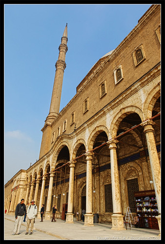
Cairo features some fantastic Islamic mosques.  The one shown above and below is Muhammad Ali Mosque, located within the Cairo Citadel.  No, it's not the American boxer.  The mosque was built between 1830 and 1848.  It's the most recognizable part of the Citadel and is easily seen from far away in the city.


Another mosque located within the Citadel is the Al-Nasir Muhammad Mosque, shown below.  It was built in the 14th Century.  The architecture of Muhammad Ali Mosque is considered of "foreign" design - it's of Ottoman/Turkish style (the Ottomans ruled Egypt for a while).  On the other hand, Al-Nasir Muhammad Mosque is of truly Arabic design.


Downtown Cairo


Downtown Cairo is located near the Nile.  One of its major landmarks is the Egyptian Museum.  It boasts a vast collection of artifacts from ancient Egypt. Although the museum could use a lot more funding and improvement of its displays, the content is impressive.

The highlight of the museum is the contents of the Pharaoh Tutankhamun's tomb.  Tutankhamun was no special ruler.  We just know about him because his tomb was the only one that was fully intact when it was discovered (apparently grave robbers missed it).  The jewelry, weapons, famous mask, etc. are very cool to see.


Next to the Egyptian Museum is the headquarters of the National Democratic Party of Egypt.  Normally, such a building would not be a landmark.  But as you can see in the photos, the building burned down.  The National Democratic Party had become the single power in Egypt - the party of which ousted leader Hosni Mubarak was the head.  On January 25, 2011, the Egyptian revolution began.  Protests turned into violence, and as a result, this building was set on fire.  There was even a damage to the artifacts in the Egyptian Museum - a shame.  Later, Mubarak stepped down, party leaders stepped down, and now the party is defunct.


Speaking of the Egyptian revolution, Tahrir Square (aka Liberation Square) is just down the street.  I had never heard of it, until I saw TV footage of the protests and violence from the revolution.  At the time, I didn't think I would be setting foot there, less than a year since the revolution began.  Even a few weeks before my trip, additional violence flared at the square.  Nonetheless, we felt compelled to check it out for ourselves.  Viva la revolucion!! :)

Even though Egypt's main attraction is its history, I found a lot of value in experiencing its current events.  The Egyptian revolution isn't just limited to Egypt; it was the catalyst for the "Arab Spring" that has erupted in the region - Libya, Tunisia, Syria.  Maybe one day, the Middle East will be a more democratic, orderly, and peaceful place.  It would be cool to say that I visited there, at the beginning of the new era.

Related links:

Tuesday, January 17, 2012

Egypt & Jordan: Trip Overview


Happy new year!  I just returned from a fabulous three-week tour of Egypt and Jordan.  It was a great feeling to walk around and experience the "Cradle of Civilization" in person.  Thousands of years ago, powerful empires ruled and built great monuments here.  The great religions of Judaism, Christianity, and Islam arose from this area.  I got to get a taste of modern history too, as the world of Middle Eastern politics and the "Arab Spring" unfolds every day.

This trip was a bit different for me because I booked a tour.  I usually travel the "do it yourself" way, but a tour of these places made the most sense.  The tour operator was G Adventures, a Canadian adventure tour company. I didn't travel with any friends this time, either.  Everyone on my 14-person tour group was a stranger to me.  Luckily, they all turned out to be great, interesting people.  Now they are my new friends! :)


We covered a lot of ground in Egypt and Jordan. We rode buses, overnight trains, 4x4 trucks, sailboats, ferries - also donkeys and camels!   You can click on the map above for a link to the tour itinerary.

The trip was a good combination of culture/history, local experience, and hiking outdoors.  It's hard to say what my favorite spot was.  Each destination was very unique and interesting.

As you probably know, I will have a ton of photos and thoughts to share.  I plan to write blog articles on the following topics:
  • The Pyramids of Egypt
  • Cairo, Egypt
  • Aswan (Egypt)
  • Luxor (Egypt)
  • Mt. Sinai and the Red Sea (Egypt)
  • The Rum Valley and the Bedouin People (Jordan)
  • Petra (Jordan)
  • Biblical Jordan

Related links:

Tuesday, November 15, 2011

Bryce Canyon National Park


Bryce Canyon is a beautiful and unique national park.  It is known for its large amphitheaters full of rock formations called hoodoos.  It's not a huge park like Yellowstone, but everywhere you go, you are able to see some breathtaking views.

Bryce Canyon actually isn't a canyon.  A canyon is supposed to be a deep gorge between two cliffs.  You'll often see a river flowing through it.  The river is a major factor for the erosion and carving of the canyon.  Bryce Canyon is different - no gorge, no river.  It's located at the border of a highland plateau and lowlands.  Erosion over the centuries has carved out large amphitheaters, or bowls, at the edge of the plateau.  The hoodoos are remnants of the plateau that are still trying to resist the erosion.  Over time, the hoodoos will fall apart.

The park is pretty easy to get around.  There is one road (~20 miles) that takes you north/south, along the edge of the plateau.  There are many viewpoints to stop at.  There are many hiking trails that start at the viewpoints too.  One challenge with hiking, however, is elevation.  Most of the trails involve going down into the amphitheaters and returning up to the plateau.  You could have a good time at Bryce Canyon just driving up to the viewpoints and skipping the hikes.  But being able to do some hikes makes the experience even better.

Sunrise in Bryce Canyon


By far, the best time to see anything at Bryce Canyon is in the early morning.  Since the plateau goes north/south, the rock amphitheaters are all located east of the plateau.  The morning sun rises behind the park, and it shines with brilliance directly on the rock.  I am no morning person, but I made it up to catch a sunrise at Bryce Canyon.  It was amazing.


There's actually a viewpoint at Bryce Canyon called Sunrise Point - what a convenient name!  We headed there and caught the sunrise.  What I learned, however, was that if you hiked a little bit on the Queen's Garden Trail, you could get a better view of Bryce Amphitheater.  There are several rock amphitheaters at the park; Bryce Amphitheater is the most well-known.  In the photo above right, I climbed up a rock column along this trail.  It was a great place to enjoy the morning sunlight (make sure you bring a coffee).

Navajo Loop Trail and Thor's Hammer


If you could only do one hike in Bryce Canyon, it should be the Navajo Loop Trail.  It's a short trail of only 1.3 miles, but the 500 foot elevation change and switchback trails can make it a challenge if you aren't in good shape. It's a circular trail, starting at Sunset Point, which is near the center of the park.  The trail takes you past three of the most well-known rock formations at the park: the Silent City (above right), Wall Street (below right), and Thor's Hammer (below center).  The Silent City is a formation of tightly-packed hoodoos.  Wall Street is a fin - long and narrow. 


Yellowstone has Old Faithful.  Arches has Delicate Arch.  The equivalent superstar feature for Bryce Canyon is Thor's Hammer.  It's a super cool hoodoo.  The base of Thor's Hammer is rock column that stands alone, in the middle of a small valley.  The "hammer" is a rock that is perfectly balanced on top of the column.  I love it!

Just to be clear, you can actually see Thor's Hammer and the Silent City from Sunset Point, without hiking the trail.  But the trail takes you down and up close, which makes the experience more amazing.  These photos of Thor's Hammer we taken from near the bottom of the trail.

Although it's called Sunset Point, you really shouldn't go there to see sunsets.  Since the highland plateau is on the west side of the park, the evening sun gets blocked.  The rock amphitheaters end up in the shade several hours before sunset.  On the other hand, Sunset Point and the Navajo Loop Trail would actually be great to see at sunrise!  If I could wake up early once more to see a sunrise, I would go here.

Bryce Point and Inspiration Point


Throughout most of Bryce Canyon, the edge of the plateau (and the main road) goes north/south.  The only exception is at Bryce Point (photo above), whether the plateau sticks out two miles to the east - kinda like a peninsula.  This gives you a great viewpoint of the Bryce Amphiteater, from the east side and looking west.  I'm told that Bryce Point is also another great place to see the sun rise.  There are some great hiking trails that originate from here (Peekaboo Loop, Under-the-Rim).


Inspiration Point (above right) is located near the main road, on the way to Bryce Point. You have a great close-up view of the Silent City.  You can also wave hello to folks at Bryce Point.

The Rest of Bryce Canyon

Bryce Canyon's main road goes for about 20 miles.  There are a bunch of other viewpoints, amphitheaters, and trails along this road.  Here are some highlights.


The photo above left is of the Natural Bridge rock formation.  Technically, it's an arch, not a bridge.  But who's counting? :)

The photo above right is of Agua Canyon.  I didn't get many good photos with evening light, but this one is pretty decent.


The photo above is from Rainbow Point, which is at the end of the main road.  Rainbow Point is the area of highest elevation at Bryce Canyon.  It also marks the highest "stair" of the Grand Staircase of the Escalante National Monument (I will explain this in an upcoming blog entry).

Conclusion

I loved Bryce Canyon.  It's a unique park with breathtaking views.  I was pretty happy with my two days at Bryce Canyon.  If you were short on time, you could easily cover the main attractions in a day.  If you like to hike, you could easily spend a few more days here. 

Upcoming articles: Zion National Park, Grand Staircase National Monument

Related links: