Showing posts with label national park. Show all posts

Tuesday, November 15, 2011

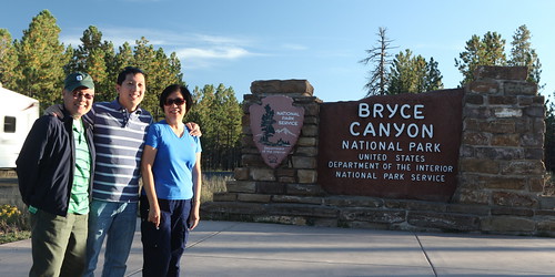
Bryce Canyon National Park


Bryce Canyon is a beautiful and unique national park.  It is known for its large amphitheaters full of rock formations called hoodoos.  It's not a huge park like Yellowstone, but everywhere you go, you are able to see some breathtaking views.

Bryce Canyon actually isn't a canyon.  A canyon is supposed to be a deep gorge between two cliffs.  You'll often see a river flowing through it.  The river is a major factor for the erosion and carving of the canyon.  Bryce Canyon is different - no gorge, no river.  It's located at the border of a highland plateau and lowlands.  Erosion over the centuries has carved out large amphitheaters, or bowls, at the edge of the plateau.  The hoodoos are remnants of the plateau that are still trying to resist the erosion.  Over time, the hoodoos will fall apart.

The park is pretty easy to get around.  There is one road (~20 miles) that takes you north/south, along the edge of the plateau.  There are many viewpoints to stop at.  There are many hiking trails that start at the viewpoints too.  One challenge with hiking, however, is elevation.  Most of the trails involve going down into the amphitheaters and returning up to the plateau.  You could have a good time at Bryce Canyon just driving up to the viewpoints and skipping the hikes.  But being able to do some hikes makes the experience even better.

Sunrise in Bryce Canyon


By far, the best time to see anything at Bryce Canyon is in the early morning.  Since the plateau goes north/south, the rock amphitheaters are all located east of the plateau.  The morning sun rises behind the park, and it shines with brilliance directly on the rock.  I am no morning person, but I made it up to catch a sunrise at Bryce Canyon.  It was amazing.


There's actually a viewpoint at Bryce Canyon called Sunrise Point - what a convenient name!  We headed there and caught the sunrise.  What I learned, however, was that if you hiked a little bit on the Queen's Garden Trail, you could get a better view of Bryce Amphitheater.  There are several rock amphitheaters at the park; Bryce Amphitheater is the most well-known.  In the photo above right, I climbed up a rock column along this trail.  It was a great place to enjoy the morning sunlight (make sure you bring a coffee).

Navajo Loop Trail and Thor's Hammer


If you could only do one hike in Bryce Canyon, it should be the Navajo Loop Trail.  It's a short trail of only 1.3 miles, but the 500 foot elevation change and switchback trails can make it a challenge if you aren't in good shape. It's a circular trail, starting at Sunset Point, which is near the center of the park.  The trail takes you past three of the most well-known rock formations at the park: the Silent City (above right), Wall Street (below right), and Thor's Hammer (below center).  The Silent City is a formation of tightly-packed hoodoos.  Wall Street is a fin - long and narrow. 


Yellowstone has Old Faithful.  Arches has Delicate Arch.  The equivalent superstar feature for Bryce Canyon is Thor's Hammer.  It's a super cool hoodoo.  The base of Thor's Hammer is rock column that stands alone, in the middle of a small valley.  The "hammer" is a rock that is perfectly balanced on top of the column.  I love it!

Just to be clear, you can actually see Thor's Hammer and the Silent City from Sunset Point, without hiking the trail.  But the trail takes you down and up close, which makes the experience more amazing.  These photos of Thor's Hammer we taken from near the bottom of the trail.

Although it's called Sunset Point, you really shouldn't go there to see sunsets.  Since the highland plateau is on the west side of the park, the evening sun gets blocked.  The rock amphitheaters end up in the shade several hours before sunset.  On the other hand, Sunset Point and the Navajo Loop Trail would actually be great to see at sunrise!  If I could wake up early once more to see a sunrise, I would go here.

Bryce Point and Inspiration Point


Throughout most of Bryce Canyon, the edge of the plateau (and the main road) goes north/south.  The only exception is at Bryce Point (photo above), whether the plateau sticks out two miles to the east - kinda like a peninsula.  This gives you a great viewpoint of the Bryce Amphiteater, from the east side and looking west.  I'm told that Bryce Point is also another great place to see the sun rise.  There are some great hiking trails that originate from here (Peekaboo Loop, Under-the-Rim).


Inspiration Point (above right) is located near the main road, on the way to Bryce Point. You have a great close-up view of the Silent City.  You can also wave hello to folks at Bryce Point.

The Rest of Bryce Canyon

Bryce Canyon's main road goes for about 20 miles.  There are a bunch of other viewpoints, amphitheaters, and trails along this road.  Here are some highlights.


The photo above left is of the Natural Bridge rock formation.  Technically, it's an arch, not a bridge.  But who's counting? :)

The photo above right is of Agua Canyon.  I didn't get many good photos with evening light, but this one is pretty decent.


The photo above is from Rainbow Point, which is at the end of the main road.  Rainbow Point is the area of highest elevation at Bryce Canyon.  It also marks the highest "stair" of the Grand Staircase of the Escalante National Monument (I will explain this in an upcoming blog entry).

Conclusion

I loved Bryce Canyon.  It's a unique park with breathtaking views.  I was pretty happy with my two days at Bryce Canyon.  If you were short on time, you could easily cover the main attractions in a day.  If you like to hike, you could easily spend a few more days here. 

Upcoming articles: Zion National Park, Grand Staircase National Monument

Related links:

Saturday, October 29, 2011

Southern Utah - Bryce Canyon & Zion National Parks - Trip Overview


Most people don't hear too much in the news about Utah.  Aside from Mormons and the Utah Jazz, what else is in Utah?  I would say it's nature.  Northern Utah has some great mountains and ski resorts.  Southern Utah is very different.  It's full of canyons, mesas, arches, spires, buttes, and other crazy geological formations.  Because of these features, southern Utah is the home to five U.S. national parks: Arches, Canyonlands, Capitol Reef, Bryce Canyon, and Zion.  On my latest trip, I visited Bryce Canyon and Zion National Parks.


This trip was just a small family trip.  I usually travel somewhere with them every two years or so.  Aside from some good quality time with their son, my parents enjoy seeing the world as well.  The travel bug must run in our genes! 


The Southwest is a vast area - big states and lots of road between locations.  I think most people fly into either Salt Lake City, Denver, Phoenix, or Las Vegas in order to visit the parks.  We flew to Las Vegas and rented a car.  Zion is only about 2.5 hours away from Vegas.


Depending on how much time you have, how much hiking/trekking you want to do, and how much you are willing to drive, there are lots of itineraries to choose from.  Perhaps the most grand itinerary is the "loop" of southern Utah - visiting all five Utah national parks, and also swinging south to Arizona to see Lake Powell and the Grand Canyon.  This sort of trip would probably take you two weeks, but it would be amazing!  I've already been to Arches, Canyonlands, Lake Powell, and the Grand Canyon (check out my blog articles on my trip to Arches & Canyonlands).  Therefore, it made more sense for me spend my time at Bryce Canyon and Zion.


Here was my itinerary:
  • Day 0: Fly to Vegas, rent car, eat, sleep
  • Day 1: Drive to Bryce Canyon (~4 hrs).  Visit Bryce Canyon.  Lodging at Bryce.
  • Day 2: Full day at Bryce Canyon
  • Day 3: Grand Staircase - Escalante National Monument (1.5h east of Bryce).  Return to Bryce in evening.
  • Day 4: Pack up from hotel at Bryce.  Drive west towards Cedar City.  Visit Cedar Breaks National Monument.  Check in to hotel at Cedar City.  Visit Kolob Canyon portion of Zion park.
  • Day 5-6: Full days at Zion
  • Day 7: Check out from hotel in Cedar City.  Drive back to Vegas.  Chill out in Vegas - and enjoy some good non-park food!
  • Day 8: Fly home
The plan worked out really well.  The durations were perfect.  The most difficult part was finding lodging near Bryce Canyon.  We had originally planned on staying in Cedar City (a decently sized town) for the entire trip, but we later realized that Cedar City was only good for Zion (1 hour away).  Bryce Canyon would have been quite far away - a painful commute back and forth.  So we decided to stay near Bryce instead.  There are only tiny tourist towns near Bryce Canyon, and hotels usually need some advance booking.  Luckily, we found a place to stay at the last minute.

My next articles will discuss my experiences in the parks.

Related links:

Tuesday, July 20, 2010

Utah 2010 Trip Intro: Salt Lake City to Moab


A business trip brought me to Salt Lake City on a Friday in July. The meeting was set up with little notice; we only had a week to make plans. Luckily, I didn't have anything huge going on the following weekend, so I decided to make a mini-vacation out of it.


You know it's going to be a gorgeous weekend when you get to see the sunset above when your plane is landing. Aaaaaah.

Utah is an amazing place - there is so much beautiful scenery and nature nearby. It is loaded with national parks. You can't visit them all in a single weekend, so I had to choose. I had already been to Yellowstone & Grand Tetons (to the northeast - and these parks are actually in Wyoming, but close enough). I had not visited Zion & Bryce (to the south) or Arches & Canyonlands (to the southeast). Since Zion/Bryce are kind of close to Vegas, which I visit at least once a year, I figured it would be a good opportunity to check out Arches and Canyonlands.


Arches and Canyonlands National Parks are located in southeastern Utah, near the Colorado and Arizona borders. When my meeting was done, I headed down there in my rental car. The drive was about 300 miles one-way - about five hours (depending on traffic). I would have two full days (Sat & Sun) to go sightseeing. I began the return trip to Salt Lake City on Monday morning, flying home that evening.

The drive started out quite dull and full of Salt Lake City/Provo Friday evening traffic. It was very hot too! Temperatures reached around 100F or more every afternoon that weekend. But once I started traveling east on I-70/US-50, the drive became very scenic. There were all sorts of mountains, cliffs, rock formations, farms, poofy white clouds, and even scenic viewpoints to stop and check out.


Arches and Canyonlands National Parks are only about 30 miles apart. The land is part of the Colorado Plateau. This highland region that spans four states (CO, UT, AZ, NM) and features the mighty Colorado River running through it. Although Arches and Canyonlands are so close, their landscapes are very different. Arches National Park features all these crazy rock formations that stick out of the ground: arches, buttles, spires, etc. On the other hand, Canyonlands National Park features huge canyons dug into the earth by the Colorado and Green rivers.


Located just south of Arches National Park is a town called Moab. It's the perfect base of operations for travelers. I stayed at the Apache Motel there. It was nothing fancy, but all I needed were a bed, a shower, and some air conditioning :) Moab is a rather large tourist town. There are many hotels, restaurants, and stores. The downtown area is cute and clean, great for grabbing a bite to eat or buying a souvenir.


Moab is also pretty cool because it's right in the middle of all this beautiful scenery. You can see the mountains and rock formations in every direction.


After a long day of business, driving, and sightseeing along the way, I got to bed early to prepare for a couple days of communing with nature. My next article: a morning in Arches National Park.


Check out this article and others from my blog:
- This article
- All articles on Utah 2010 trip
- Blog home

Monday, July 19, 2010

A Morning in Arches National Park


Arches National Park is a beautiful place, with a unique geology that features crazy rock formations everywhere.  You can see over 2000 monoliths, rock fins, spires, balanced rocks, and natural arches in the park.  Here's a cool interactive map of the park, from the official park website.

I made two trips to the park: one on Saturday morning, and the other on Sunday evening. I took siestas at the hotel in the early afternoons - noon sunlight isn't that cool for photography, and it was pretty darn hot in the afternoons! Morning sunlight is quite different from afternoon sunlight. Also, certain landmarks at the park are better oriented for either the morning or evening sunlight. For example, the famous Delicate Arch is shot best at sunset (which I did!). This article covers my morning experience at the park.

Sunrise at the Windows

I have resolved to get up for sunrise photos on many trips in the past.  However, this trip was the first time in which I followed through on the idea.  I woke up at 5am, got my gear ready, and arrived at the park by about 6am, just before the sun rose.  There are several areas of the park.  I went to the Windows area to catch these sunrise photos.

The following shots were taken at the South Window:


Facing the Windows is Turret Arch. Turret Arch is really neat in the morning because the sun shines right on the face of the arch.


Just a short hike away from the Windows is Double Arch. It's pretty neat because the two arches share a common foundation pillar. Double Arch was in some scenes of the movie Indiana Jones and the Last Crusade.


Devil's Garden Area

The Devil's Garden Area is located at the end of the 18-mile scenic drive through Arches National Park.  Devil's Garden contains several trails that lead to a bunch of arches.  The first part of the main trail is about a mile long and is an easy hike.  The scenery on the trail is great, especially with all the large rocks protruding from the ground.


The easy part of the trail ends at Landscape Arch. Landscape Arch is the longest arch in the park and one of the longest natural rock arches in the world. The photo at the beginning of this article is also of Landscape Arch.


Beyond Landscape Arch, the Devil's Garden Primitive Loop begins. The loop itself is about 7 miles long, plus a few side trip hikes to see specific arches. It's a difficult hike. You have to hike up and down sandstone slabs, and sometimes along high rock ledges. The views are amazing though. Just make sure you bring plenty of water!


Partition Arch is one of the side trips off the Primitive Loop. You can see the arch from afar on the main trail (you can barely see it in the photo above). But the side trip takes you behind the arch, and you can walk under it. You can get a nice view of the Devil's Garden area from under the arch.


Navajo Arch is another landmark you can see on a side trip from the Primitive Loop.  While the hike around its back side is rather dull, the front side is kind of neat because it looks like you're hiking in a cave or ravine.


In Conclusion

Arches National Park is a beautiful, unique place.  It's totally worth it to get there early to enjoy the sunrise and the morning light.  After an early start and over ten miles of hiking, I was hungry for a nice lunch and then a siesta.  I ended my morning adventure at this point and headed back to Moab.  Articles to come: Canyonlands National Park, Dead Horse Point State Park, and Evening in Arches....

Check out this article and others from my blog:
- This article
- Part 2 of my Arches experience
- All articles on Utah 2010 trip
- Slideshow of Utah 2010 trip photos on Flickr
- Blog home

Sunday, July 18, 2010

Dead Horse Point State Park


It was late Saturday afternoon in Moab.  I had just woken up from a peaceful air-conditioned siesta in the hotel, while the sun was bearing down outside with 105F temperatures. Hopefully it had cooled down a tiny bit. Time to head out again and do an evening hike.

The original plan was to go back to Arches National Park.  But as I went outside to the car, I noticed that the sky had gotten rather cloudy, just in a few hours.  All that heat and humidity builds up weather systems so quickly!  I figured that all the clouds would prevent good evening sunlight from shining on the arches. So it was time to head elsewhere. I decided to go west to Dead Horse Point.

Before arriving in Moab, I had never heard of Dead Horse Point State Park.  And even if I had heard of the park, why would I go all the way to Utah to visit a state park??  There are all sorts of national parks around, duh!  But I spoke to my buddy Rob, who had been here a week ago, and he recommended going there.  Taking a look at some pics online, going there surely made sense.  It looked spectacular!  I guess when you're in the Great West, even a state park can blow away anything you see in the flat, corn-filled midwest.


Dead Horse Point State Park is about a 30 mile drive from Moab.  It's right next to Canyonlands National Park.  I actually don't understand why they didn't make it part of Canyonlands.  The scenery/geology is pretty much the same.  

The drive to Dead Horse / Canyonlands is very scenic.  There are viewpoints for you to pull off and take photos or have a picnic.  There are some great views of the La Sal Mountains to the east (first two photos below), as well as nearby rock formations like Merrimac and Monitor Buttes (third photo below).


Here's a more detailed map of the park, from the official park website.  The park is pretty small and simple.  There's only one road in the park.  The road overlooks canyons on both sides.  It ends at Dead Horse Point.  Sounds like there are some great hikes, especially if you want to go down into the canyons.  But if you are lazy like me and just want to snap photos, there are several great overlooks.


Looking to the east, you can see Pyramid Canyon and the Shafer Basin.  The La Sal Mountains are in the distant background.  Here are some shots, the first two from the Basin Overlook, and then the Pyramid Overlook.


The true gem of the park, as the name suggests, is Dead Horse Point.  Dead Horse Point sticks out into the canyon.  You get a beautiful panoramic view of the area, which includes the Colorado River curving in a "gooseneck" shape.


Finally, I leave you with a panorama photo of Dead Horse Point.  Click on it to view it in full screen mode.


Check out this article and others from my blog:
- This article
- All articles on Utah 2010 trip
- Slideshow of Utah 2010 trip photos on Flickr
- Blog home